Google(Google) satellite enters预定 orbit
Recently, space has become increasingly crowded. China's Shenzhou VII manned spacecraft has just returned in triumph, while GeoEye-1, the satellite launched by Google across the ocean, has recently sent back news that it has entered its intended orbit.
GeoEye-1 not only works for Google but also provides intelligence for the U.S. National Geospatial-Intelligence Agency's NextView program.
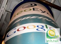
The online map of search giant Google has exclusive rights to share images from GeoEye-1, which will be used in its Google Earth and Google Maps products. Its company logo was even emblazoned on the Boeing carrier rocket.
According to Reuters, GeoEye-1 was launched early Saturday morning at the Vandenberg Air Force Base in California. By afternoon, the satellite had separated from the second stage of the Delta 2 rocket and initialized its onboard systems.
Fans of Google Earth are in luck as high-definition photos taken by GeoEye-1 have already been transmitted back. The photo captured Kutztown University in Pennsylvania. Google Earth will eventually adopt these photos. Click here to view the campus photo of Kutztown University sent back by GeoEye. Google and GeoEye have an agreement granting exclusive online use of GeoEye-1 satellite images. GeoEye-1 can capture objects as small as 41 centimeters, but according to U.S. law, Google will ultimately release photos with a clarity of 50 centimeters. The photo of Kutztown University was taken at noon.