[Photo Group] China Develops Its Own Version of Google Earth: Geo Globle
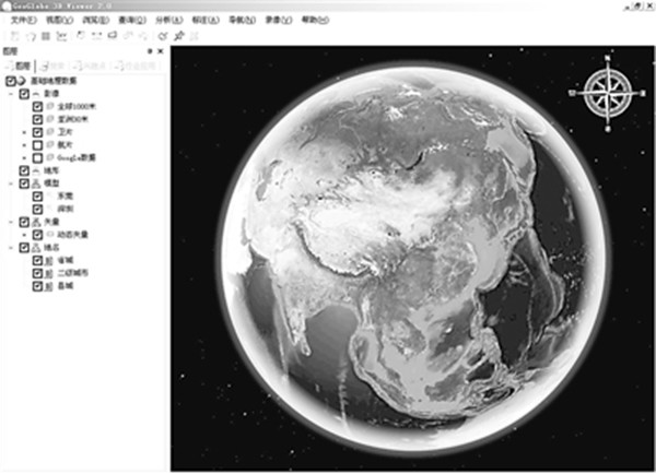
Many people like to play Google Earth, but after all, this globe is an imported product, and definitely not as localized as a domestic one. The latest news: the National Administration of Surveying, Mapping and Geoinformation made a strategic decision on the eve of the Spring Festival to launch the "National Geographic Information Public Service Platform" construction project, creating China's own "Google Earth" (Geo Globle). This software can process data from multiple sources simultaneously, including 3D topographic maps, aerial imagery, 3D models, as well as vector data such as geographic boundaries, railways, highways, and air routes, which are not available on "Google Earth".