Google Maps Upgrade: Highest Resolution at 3 Inches Per Pixel
by jgbell on 2006-04-26 00:51:54
Google's Google Maps service has recently undergone another major upgrade. Thanks to the significant expansion of the Google Earth database, the resolution of satellite/aerial photos in Google Maps has improved to a new level.
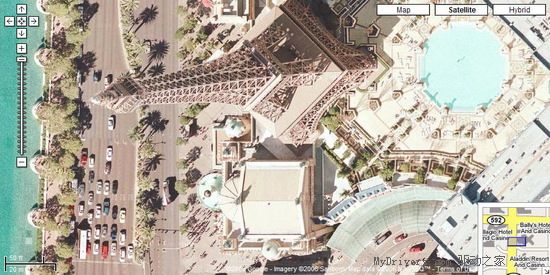
In the upgraded Google Maps, high-resolution satellite/aerial images are now available for the entire country of Germany and most parts of Europe. The city of Las Vegas, known as the gambling capital, even reaches a resolution of 3 inches per pixel, and many other areas have also been revealed in much greater detail.