在Google Earth里面看Flickr照片 » Flickr中文网 - Flickrcn.com
by shizhao on 2006-11-29 19:41:26
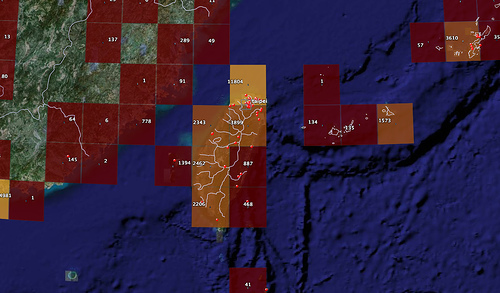
Flickr加上geotagging功能之后,到目前已经有超过六百万张照片被标在地图上。不过,想要知道哪些地方被标了最多的照片,在Flickr Map上是没办法看到的。还好我们有Google Earth,要知道照片在地图上的分布状况,只要到这里下载Flickr Photo by Location这个KMZ,就可以在Google Earth里面看到一个个由红到黃的方块,代表地区照片的多少,上面还有精确的照片数量。