Google Maps/Earth updated high-definition satellite images on September 8th.
by 8o8o on 2006-09-10 03:55:43
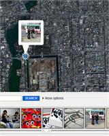
Starting from September 8th, Google Maps began a new round of updates for high-definition satellite images. It has now been confirmed that the updated countries/regions are mainly concentrated in the United States (California, Texas, North Carolina, Connecticut, New Hampshire, Florida, Maine, Georgia), Canada, Belgium, Netherlands, Norway, Japan, Thailand, and New Zealand.
On September 9th, the satellite images of the aforementioned regions were also updated on Google Earth.
In China, updated satellite images have only been found in areas near Hangzhou so far. If anyone else has other new discoveries, feel free to leave a comment.