More vivid! Google Maps adds new terrain icons
by cacard on 2007-11-29 23:40:09
Google Maps is a mapping service introduced by Google. Recently, a new view mode has been added that can vividly display the terrain or landscape of a certain area.
Now, through Google Maps, you can check the elevation of various regions on Earth, such as mountains, lakes, plateaus, plains, and oceans, which will be presented more vividly, allowing you to grasp the information at a glance.
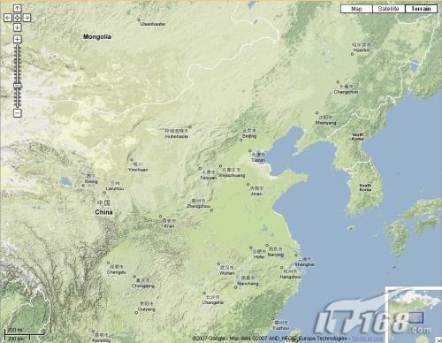
To do this, when viewing a map of a certain area in Google Maps, click "Terrain" in the upper right corner to see the topography of the region. For example, when using Google Maps to check...